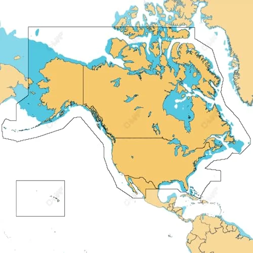
C-MAP Discover North America Lakes US/Canada Map Card for Marine GPS Navigation
USD $129.00
- Condition:
- NEW
- Shipping:
- Free Shipping
- SKU:
- M-NA-Y200-MS
- Categories:
- Marine GPS Units & Chartplotters / Spend $100 or more, get $25 off select Sports & Outdoors


Price alert
Notify me when the price drops
Description
Ultra-wide coverage: our largest geographical coverage, without compromising on chart quality full- featured vector charts: making navigation easy by giving you accurate, up-to-date vector chart detail derived from official hydrographic office information hi-res bathymetry layer - helps you identify shallow areas, drop offs, ledges, holes or humps. now includes the very best of c-map hrb data, with integrated genesis social map data subscription-free autorouting - automatically plot the shortest, safest route based on detailed chart data and your personalized vessel information custom depth shading: set a clear safety depth, maintain a paper-like view or create your own custom shading compatibility: this discover product is only compatible with the following lowrance, simrad, and b&g models: hds pro, hds live, hds carbon, elite-fs, elite-ti2, elite-ti, eagle, nssevo3s, nssevo3, nssevo2, nsoevo3s, nsoevo3, nsoevo2, go installation: this product comes programmed on a micro-sd fitted in a sd card, most chart plotters come with a micro sd card reader. to use this chart the micro-sd card needs to be removed from the sd adapter color: black size: 5.83 inches by 4.09 inches weight: 0.0881849048
Market history
Price Tracking
Related picks